Planning a road trip is one of the most exciting parts of the experience. When you first decide to go on this adventure, you’re filled with anticipation and possibilities.
But it can also be overwhelming. Where do you start? How do you find interesting places? How do you keep everything organized?
Don’t fret; I’ve got you covered. I’ve found the best road trip planning tools to help make the process fun and easy.
I’m somewhat obsessed with road trips, and have written a few books about them (including Planning Your Perfect Road Trip) as well as dozens of articles.
With the help of the right road trip planning tools, you can make the process much simpler, more organized, and fun!
Below are some of the best road trip planner apps, websites, and real world tools to help you plan your next road trip. They’ll help you find great places to explore, figure out how to get there, and keep track of it all.
Ready to plan a road trip?
Best Road Trip Planning Tools and Apps
There may be affiliate links in this post, which means we may get a small commission. It’s at no extra cost to you and helps keep TLT free. Everybody wins!
Before you go, check out this road trip packing list.

15 Useful Websites for Road Trippers
There are approximately 1.3 gazillion travel websites, give or take a few bazillion. There’s no way to keep up with all of them. I’m not even going to try. Instead, I’ve curated some useful favorites.
This selection of trip planning websites is by no means comprehensive (because that would be impossible), but these should provide a plethora of ideas.
America’s Byways
fhwaapps.fhwa.dot.gov/bywaysp/
If you’re looking to drive a scenic route that’s been designated as such by the Federal Highway Administration, visit here first.
National Scenic Byways & All-American Roads lists a collection of 184 “distinct and diverse roads.”
To be officially designated, a National Scenic Byway must be considered regionally significant, and an All-American Road needs to be a “destination until itself.”
For example, the Santa Fe Trail follows one of the country’s early trade routes and is a National Scenic Byway.
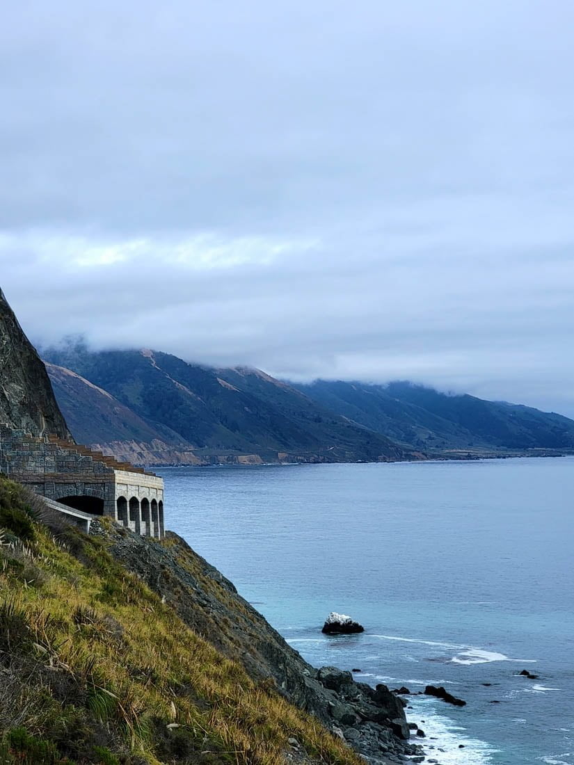
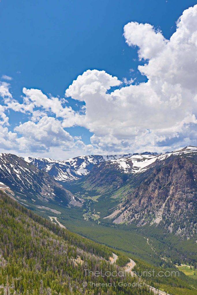
Beartooth Highway, which provides access to the northeast entrance of Yellowstone National Park, is an All-American Road.
America’s State Parks

Our National Park System gets lots of love, and rightfully so, but you know who else deserves your outdoor affection?
State parks.
The America’s State Parks website, hosted and developed by the National Association of State Park Directors, is exactly what it sounds like. It’s a resource to help you find every state park in the country.
Their Locate a Park function links to each state’s official parks system website.
Atlas Obscura
Welcome to the atlas of the obscure. If you’re looking for interesting places, this is the site for you.
A cool function is to search nearby. Let the site use your location and it’ll pull up attractions close to you.
For example, near me there’s a funeral home with a mini-golf course inside and a house without corners – because the owner wanted spirits to feel more comfortable.
Back Road Ramblers
Back Road Ramblers focuses on family-themed travel in the US, emphasizing slower-paced journeys and off-the-beaten-path adventures.
CalcMaps
If you want to visit someplace new and know how far you’re willing to drive, CalcMaps will show you what’s within that distance.
Draw a circle and it’ll show the radius in miles, or enter an address and the miles you’re planning on driving. A circle overlay will display on the map, which you can resize with the drag of a mouse.
You can then browse within that circle and start researching potential cities, towns, parks, and attractions. It’s important to note that mileage is based on straight lines and not the routes you’ll take.
For example, from my home to Des Moines, Iowa, is less than 280 miles as the crow flies. To drive it would be around 320 miles. However, you can at least get a rough idea.
Find Your Park
Find Your Park is a collaboration between the National Park Service and the National Park Foundation to help plan visits to NPS sites.
You can choose from a range of activities, including geocaching, off-roading, and whitewater rafting.
Historical Marker Database

If you’re the type of person who pulls over at every historical marker, Historical Marker Database is going to be your new best friend.
You can browse thousands of listings or you can plug in an address. If you give it permission to see your location, it’ll show markers near you.
Individual listings display an image of the marker, a transcription of the inscription, and usually an audio recording. They include the latitude and longitude so you can plot the exact location.
Topics are also listed, which comes in handy when planning a road trip themed around Native Americans or the Civil War, for example.
National Park Service

If you plan to visit any of the 423 units of the National Park System, start at the source. NPS.gov includes all their sites, including National Battlefields, National Monuments, National Historic Sites, National Scenic Trails, National Seashores, etc.
They also help you plan your trip with lists of ideas. There are trip ideas by park, activity, topic, duration, and more.

You can also purchase your America the Beautiful Interagency Pass, which provides admission to every fee-based NPS unit.
National Register of Historic Places
History geeks rejoice! Part of the National Park Service, the National Register of Historic Places offers tools and resources for researching historical sites deemed worthy of preservation.
RoadTrip America
Online since 1996, RoadTrip America is one of the original sites for online travel planning. In addition to tons of road tripping advice, there’s also a route planner.
It’s free, and if you want to save, print, or modify your route, you’ll need to register. That’s also free and provides access to their Great American RoadTrip Forum where you can connect with other road trippers.
Roadside America
Roadside America‘s also been around since the 1990s, and in all that time it’s amassed a giant collection of curiosities. Or, as they say, “little pushpins of peculiarity.”
Browse by state or search by keywords or city to find your road trip inspiration, like a giant ball of twine or a 30-foot-tall old-fashioned bicyclist.

See something intriguing? Save it to “My Sights.” When you’ve accumulated the ones you want, you can create a route that includes them all.
There’s a Roadside America app, but sadly for us Android users, it’s only available for Apple devices.
The Local Tourist
I’d be remiss if I didn’t include my own website. It has been around since 2002, after all.
The Local Tourist is a good resource for outdoors, culture, history, kitschy attractions, and road trips (duh).
As of 2024, destinations are primarily in the Midwest and Western United States. But, I’m working on covering the whoooole country, and eventually, the world! Muah ha ha.
TV Food Maps
Want to eat at a place you’ve seen on the telly? TV Food Maps not only has a searchable database, but they’ll also show you results based on your road trip route.
Shows include the obligatory Diners, Drive-ins and Dives and Man vs Food. There’s Cheap Eats when you’re on a budget. Chopped fans can find the winners’ restaurants.
It’s a veritable smorgasbord of places to eat.
Related: check out all my tips on eating on the road.
Visit the USA
Visit the USA is the official travel site of the United States. There’s a ton of information for people traveling internationally, but it’s also good for US residents.
Browse iconic landmarks, trip ideas, and experiences. You can search geographically. There’s also a cool “this or that” quiz that provides recommended trips based on your answers.
In addition to the site, there’s a trip planner, too. Put in your starting point and your final destination and the dates you’ll be traveling and you’ll get a suggested itinerary.
Not every place is listed, however. My hometown is missing, so I entered the closest bigger city.
Want more road trip tips? Download Planning Your Perfect Road Trip, a Step-by-Step Guide to Hittin’ the Road
World Waterfall Database
If you love waterfalls (and who doesn’t?), you’ll love World Waterfall Database. It’s a comprehensive resource that ranks waterfalls and allows users to browse by state and country.
6 Online Trip Planners
Trip planners are fantastic tools for, you guessed it, planning your trip.
Road trip planners are especially useful when you have an idea of where you want to go. You plug in your start and end destinations and fill in “waypoints,” or stops.
With their interactive maps, you can experiment with alternative routes. Each tool has a different interface and offers different features.
I recommend experimenting with each to see which works best for you.
Furkot
Furkot is an online road trip planner that offers a range of features to help you plan and organize your trips effectively.
To begin, you enter your starting and ending destinations, what dates you’ll be traveling, how long you want to travel each day, and more.
You can also enter what type of accommodations you like and whether you prefer to drive highways or toll roads. Traveling with pets? You can include that, too.
If you’re not sure where you want to go, you can click on “Inspire me” for suggestions.
Google Maps
Did you know you can use Google Maps as a trip planner? When you find a place that looks interesting or you know you want to include on your itinerary, you can save it.

For example, search for Rocky Mountain National Park. Then tap the “Save” icon. From there, you can add it to Favorites, Want to go, Travel plans, or Starred places.
You can also create your own lists, which will make it easier to plan an entire trip.
Once you add a place to a list, you can add a note.
Maybe Aunt Sue recommended the peach pie at a diner. Write it down in the notes. Then when you’re planning your itinerary, you’ll know why you added that diner to your list.
You can keep your list Private or you can choose to share it. This comes in handy when there are multiple people planning the trip.
Google My Maps
Google My Maps is a powerful tool that can be extremely useful for planning a road trip. It allows you to create custom maps with your own locations, routes, and markers.
One of the most useful features of Google My Maps is the ability to create custom routes. You can add as many locations as you want to your map, and then easily connect them to create a custom route.
This can be helpful when planning a road trip with multiple destinations, as you can see the entire route and estimate the time and distance between each stop.
You can add markers to your map, which can be used to indicate points of interest, hotels, gas stations, rest areas, or other places you want to visit or stop at during your road trip.
You can add notes, photos, and videos to the markers, which can be helpful for remembering more details about a place.
Google My Maps also allows you to share your maps with others, which can be especially useful when planning a road trip with a group of friends or family.
You can share a link to your map, and others can view and edit it, making it easy to collaborate and plan your trip together.
Another useful feature of Google My Maps is the ability to export your map to a GPS device, which can be helpful when you are on the road.
This allows you to use your custom map offline, without an internet connection and navigate with turn-by-turn directions even in areas with limited cell service.
Overall, Google My Maps is a powerful and versatile tool for planning a road trip. With its custom route and marker features, collaboration options, and offline capabilities, it can help you plan and navigate your road trip more efficiently and enjoyably.
Roadtrippers.com
Roadtrippers.com allows you to plug points into a map, but it’s so much more than that.
Once you’ve added your starting point and your destination, Roadtrippers displays attractions along your route. The more you zoom in, the more attractions you’ll see.
You can add the type of vehicle you’re driving and its estimated fuel efficiency and Roadtrippers will calculate your approximate expenses.
Besides plotting the route itself, there’s a ton of user-generated content offering recommendations for attractions, restaurants, places to stay, and great photo ops.
Previously you could specify whether you wanted to drive interstates or not per segment of your trip. That’s no longer the case, and to choose any routing options you’ll need to upgrade.
However, upgrading enables you to collaborate with other users and increases the number of waypoints from three in the free version to up to 150.
There are three levels of membership, with Premium getting you the most benefits with downloadable maps, live traffic, and special discounts.
At time of publication, Roadtrippers membership ranges from $35.99 to $59.99 per year, and there’s a seven day free trial. If you upgrade, you can save $5 off your first year with code BTR5QTP. Click here to start your free trial.
TripTik by AAA
AAA’s TripTiks have come a long way since the spiral-bound guides of my youth. Today you can plan your trip online or on your phone.
Plug in your starting and ending points and add up to 25 stops. Specify how often you’d like to stop and it’ll build breaks into your turn-by-turn directions.
You can choose to display gas stations, attractions, campgrounds, hotels, restaurants, AAA savings, and rest areas.
My Scenic Drives
My Scenic Drives is a completely free trip planner that lets you add as many stops, or waypoints, as you like. After you create an account, you can plan away.
Plan road trips either by adding your own locations or by choosing one of their existing scenic drives. Those are somewhat limited.
At time of publication, only Great River Road and Stagecoach Trail are listed for Illinois, skipping Route 66, the Ohio River Scenic Byway, the National Road, and Lincoln Highway.
Depending on how many miles your trip will be, My Scenic Drives may split it up into days. You’ll also see an estimated fuel cost, although I’m not sure how accurate that is.
If you’re planning on visiting any National Park Service sites, you can buy an annual pass through My Scenic Drives.
The interface is a little awkward and they don’t have an app, although their site is mobile friendly.
Want more road trip tips? Download Planning Your Perfect Road Trip, a Step-by-Step Guide to Hittin’ the Road
16 Best Apps for Road Trips
From before you go to when you’re on the road, there are tons of tools to help get the most out of your road trip. Because of the fluidity of online tools, I’m only recommending a few that I know are likely to continue.
You can learn more about these apps in our Best Road Trip Apps guide.
Search the Apple or Google Play stores to download them to your device.
AllTrails
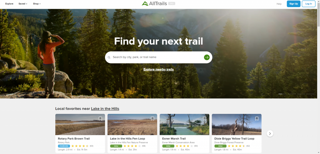
Like to hike? Bike? Go for a walk? AllTrails is a great app to help you discover hiking and biking trails based on where you’re located.
You can read reviews, store trails you’d like to explore, and record the hikes you do take. You can choose to make your hikes public, or keep them private.
There’s also a premium version, which allows you to download offline maps.
Expedia

With Expedia, you can easily search for and compare prices on rental cars, hotels, and activities along your route. Rates are often discounted, and you have the opportunity to earn rewards.
When you sign up for an Expedia Rewards account, which is free, you also get access to member prices.
The app is easy to use and keeps an itinerary with your confirmation numbers.
GasBuddy

Until electric cars have battery life that will take you through the country’s most remote stretches, gas is a necessary evil of the road trip.
GasBuddy uses crowd-sourced data to provide real-time information on gas prices at different stations.
With GasBuddy, you can easily find the cheapest gas prices near you, as well as see which gas stations have the best deals on certain days of the week or at certain times of the day.
In addition to displaying fuel prices, you can save more when you sign up for Pay with GasBuddy.
Pay with GasBuddy also gives you access to Deal Alerts, which knock the price down even more.
Check out our complete guide to saving money on gas with GasBuddy.
Google Maps
I almost feel like this goes without saying—but I’ll say it anyway (obviously): if you have just one road trip app, make it Google maps.
Not only can you get directions and the best routes, but because it’s Google you can find anything around you, too.
One of the route options you can choose is which is most fuel-efficient, and you can even select the type of fuel: Gas, Diesel, Electric, and Hybrid.
Another great feature of Google Maps is the ability to download maps for offline use.
This is helpful if you’re planning a road trip to a rural area or somewhere with limited cell service.
By downloading the maps in advance, you can still access them and navigate even if you don’t have an internet connection.
Google Maps can also be used as a trip planning tool, and there’s more on that in the Online Trip Planners section.
HotelTonight
If you’re looking for a last minute hotel room, HotelTonight wants to help. Primarily in larger towns and cities, the website and app can help you find same-day and next-day hotel stays at discounted rates.
The app will find accommodations near you, and you can also search for hotels by location. You can filter your search by price, star rating, and neighborhood.
iExit
Taking the interstates? iExit shows you what’s available at each exit, including dining, shopping, restrooms, and attractions. It also pulls up gas stations and gas prices.
The app uses real-time data to provide information on the services and amenities available at upcoming exits on the highway, making it an ideal tool for planning rest stops, gas fill-ups and meals.
You’ll see a list of services such as restaurants, hotels, gas stations, and rest areas along with their distance from the exit. You can filter your search results by categories such as fast food, lodging, and gas stations.
NPS (National Park Service) App
Not only does the official mobile app of the National Park Service show you where to find National Parks, it helps you discover every site in their system. It’s free to use and you can explore by topic, by activity, by state, or near your location.
The app provides information on park hours, fees, and regulations, as well as maps, trail guides, and other resources to help you make the most of your visit.
Priceline
The commercials ain’t lyin’—Priceline Express Deals are amazing. What’s the catch? You have no idea where you’ll end up. You can see a general area and a star level, but that’s it.
While they no longer give you the option to Name Your Own Price, in addition to Express Deals, they also have pricebreakers. They pick from one of three different hotels.
While you won’t know which one you’re getting until you pay for it, you’ll be able to see in advance what your options are.
Like Expedia, you can search for hotels by location, price, and amenities. You can also search by brand and star level, making it easy to find a hotel that fits your budget and preferences.
Priceline VIP is a rewards program that provides discounts, add-on deals, and Express Deal coupons after your trip is complete.
The app will show you deals on hotels near your location. You can also book rental cars, flights, and cruises.
Rainy Days

Knowing what’s happening weather-wise is kind of important when you’re on a road trip. My favorite way to see whether I’ll stay dry or will need to break out the slicker is Rainy Days.
This free radar app has helped my anxiety level on several occasions, especially while driving in North Central Nebraska. It was good to know we were driving the opposite direction of an intense storm.
Recreation.gov
Recreation.gov is the official website and app for making reservations for recreational activities and facilities managed by the U.S. federal government.
You can find campgrounds and lodging, tours and activities, sign up for lotteries for the most popular things to do, and find information on what permits are required near you.
Once you do make reservations, they’re stored in the app.
This is the site and app to use when you plan to visit parks that require vehicle registration, like Glacier National Park, or want a permit to hike Angels Landing in Zion National Park.
You can reserve campsites on the website and app. We did, while sitting at the entrance to a campground in Mississippi. We didn’t realize the park was a NPS site when we drove up, and the kindly gent in the booth directed us to make our reservations through the app.
There’s also a trip planner. Plug in your dates, number of people, your starting location, and your potential destinations.
You can then see all the available options on a map, add them to your road trip itinerary, and then make any necessary reservations.
ReserveAmerica

If you’re planning to camp on your road trip, you’ll want this app. ReserveAmerica enables you to make reservations for campsites all over the country.
Some state park systems use the site, and you can find KOA campgrounds.
Apex Club is ReserveAmerica’s membership. Members get a rebate for a free night of camping (up to $25) at eligible state and regional parks. There are also discounts on gear, accessories, apparel, and activities.
Restaurant.com
Eating where the locals eat is a great way to get a real “taste” for a town. If you want to save some dough on your dining, sign up for restaurant.com.
This app provides discounted certificates, and I’ve found participating restaurants in towns with fewer than 10,000 residents.
You’ll have to spend a minimum amount to use your certificate, and it’s usually double the face value. For example, if you get a $10 certificate for $4, you’ll have to spend at least $20 and you’ll save $6.
You can search for restaurants by your current location and by zip code. You can also choose larger cities, including Chicago, Seattle, and Austin.
Once you’ve narrowed down the location, look at the menu and the ratings. I’ve found several real gems using this app, and they’ve been places I never would have known about or tried without it.
SpotHero
If you’re going to be in any urban areas on your road trip, you’ll definitely want this app.
SpotHero has probably saved me thousands over the years. I’ve been using it since it launched over a decade ago (and the founder used to write articles on Chicago parking for me!).
I found a spot three blocks from the Los Angeles Convention Center on the day of the Grammys and paid $10 for seven hours. The day of the Grammys, y’all!
TollGuru
Driving highways or in urban areas? TollGuru provides detailed information, including pricing, methods of payment, and which transponders (E-ZPass, SunPass, FasTrak, TxTag, etc.) are accepted at tolls.
It will also give you an estimated fuel cost if you include the type of vehicle you drive and the average gas prices.
While Google Maps now provides toll price information, TollGuru gives you more detail.
Upside
Upside is a free app that gives you cash back on gas, groceries, and restaurants. Brands include most of the big fuel chains (Shell, Marathon, Valero, BP, etc.).
Upside works similarly to Pay with GasBuddy in that you get cents off per gallon, but you get it in the form of cash back.
For example, at the Casey’s near me I can get eight cents per gallon cash back. To get the discount, I claim the offer, pay with a credit card, and then check in or take a photo of my receipt to upload it.
Once the cash back processes, which is usually within a couple days, I can transfer it to my bank account or use it to buy gift cards for places like Domino’s, H&M, and Starbucks.
Upside also offers cash back at restaurants and grocery stores. The offers vary, and when you first sign up there’s an increased discount.
The app saves you a few cents here and there, but they add up, especially when you’re on long road trips.
Waze
Download Waze for an alternative to Google Maps. Beyond turn-by-turn navigation, one of the key features of Waze is its crowd-sourced traffic information, which allows users to report accidents, road closures, and other incidents in real-time.
This helps you stay updated on the latest traffic conditions and avoid any delays on your route.
You can set your type of vehicle for preferred routes, including Motorcycle, Electric, and Taxi. You can also add your Toll and HOV passes, and you can tell it to skip unpaved roads.
I can think of a few trips I’ve taken where that option would have come in handy.
In addition to its routing and traffic features, Waze also offers a number of other useful tools for road trips.
For example, the app allows you to find the cheapest gas prices along your route, restaurants, and parking at your destination. If you connect your calendar, the app will tell you when it’s time to leave.
Want more road trip tips? Download Planning Your Perfect Road Trip, a Step-by-Step Guide to Hittin’ the Road
4 Real World Trip Planning Tools
While online discovery tools are wonderful, don’t forget to check out these real-world tools, too.
Travel Shows
Travel Shows are a fun and interactive way to find new destinations. While many people attend hoping to connect with someplace exotic (a.k.a. a place requiring several hours in a plane), travel shows are a wonderful way to find someplace a little closer to home.
I’ve exhibited and spoken at the Travel & Adventure Show for years. At each show, I’ve found new road trip destinations.
Places I’ve visited as a direct result of these shows include Cottonwood, Arizona; Ridgeland, Mississippi; Bishop, California, and Traverse City, Michigan.
The people working the booths at travel shows are, generally speaking, from that destination. They know more than anyone about their home and it’s their job to entice you to visit.
Libraries & Bookstores

Libraries and bookstores are fantastic resources for helping you plan your destinations. It’s fun to browse the stacks to see all the possibilities.
When it’s time to narrow down your choice to specific destinations, you might be able to find a guidebook.
If a book you want isn’t available at your local library, it could be available through a reciprocal lending program, and booksellers are usually happy to special order books they don’t stock.
It’s also fun to read travelogs and travel memoirs for ideas and inspiration.
As an author, one of my biggest thrills is when someone tells me my books provided inspiration for their trips, especially when they go somewhere they never would have considered or had never heard of before.
AAA

One of my road trip rules is to always visit AAA before heading out when I’m planning on visiting a new state.
Why? One word: Maps.
Even though GPS is great, sometimes, like in the canyons of Utah or the middle of the Mojave Desert, it doesn’t work. That’s why we always have paper maps.
AAA’s app is also a good resource on the road, if you do have a connection, for finding attractions and restaurants. PLUS, don’t forget their roadside assistance.
If you’re of a certain age (cough cough) you probably remember those spiral-bound TripTiks. When I was growing up, mom and dad would pick up their custom‐made travel guides from our local AAA.
Guess what: the association still offers these route‐planners, only now they’re online.
One of the coolest features is the ability to specify how many hours you want to drive before taking a break and it will suggest locations to stop.
It also shows places that offer discounts to AAA members, including hotels and restaurants. It’s a handy overall tool for any road trip planning.
Local Visitors Bureaus
My favorite part of travel is the people. On our road trip to the Oregon coast and back, not a whole lot was planned. We relied on the kindness of locals to point us in the right direction, and we were richly rewarded.
People who live where you’re going are always your greatest resource.
While you could drive by the seat of your pants, like we did, there’s an easier way:
These gems are my (not so) secret weapon.
When you’re planning your trip, make sure you contact these founts of regional knowledge.
In the “biz” we know them as CVBs—Convention and Visitors Bureaus—and DMOs—Destination Management Organizations. These are the Mother Lode of local info.
Once you’re at your destination, ask the people you meet—the gas station attendant, the cashier at the grocery store, the concierge at your hotel, the host of your B&B—where they go to lunch.
Where do they take friends and family when they come to visit? I’ve never been steered in the wrong direction, and have found some real gems just by asking the locals.
I hope you’ve found these road trip planning tools useful. If you want the ultimate guide to how to plan a road trip, get Planning Your Perfect Road Trip, a Step-by-Step Guide to Hittin’ the Road.
